#23 Mount Buckskin – 13,865 ft.
Date: May 10, 2013
Team: Dav, Jon Kedrowski, Matt Lanning
Route: North Face
First off let me say that the spring skiing season is in full effect in Colorado and the skiing is awesome out there right now. Coming off a wet two weeks, the mountains are coated with powder snow and much of it lies on top of a stable, frozen spring snowpack. You can expect this new powder to sluff on the older, denser layers, but it can be quite easily managed. So, now onto today’s skiing…
Mt. Buckskin has actually been on my radar for many years. I remember driving over Fremont Pass back in college and marveling at the huge glacial valley that forms the headwaters of the Arkansas River, and bends underneath the west face of Democrat and over to Buckskin. Then, many years later I was on ski tour up Mt Arkansas with Nick Devore after getting skunked on Princeton (to rocky… what’s new). We hit the summit and immediately we were tractor beamed by the awesome and complex north face of Buckskin. I remember discussing the options on that face and as we skied Arkansas I wondered if I’d be back any time soon to give it a go?
Well here we are seven years after my “Ski the 14ers” project and I’m finally making it up that wild valley to ski Buckskin, and in awesome powder conditions. I was joined by my old college and ski racing buddy Matt Lanning, who lives in Breck, and Dr. Jon Kedrowski, a Vail local who recently slept on the summit of 58 points over 14,000′ in Colorado.
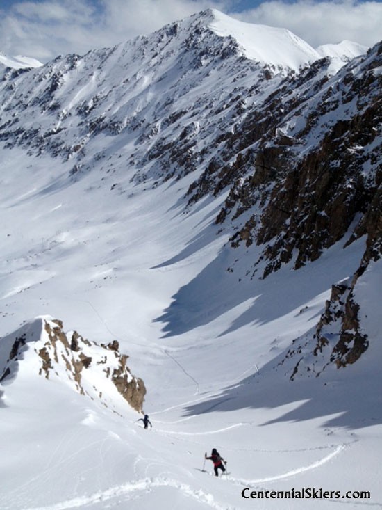
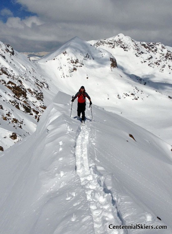
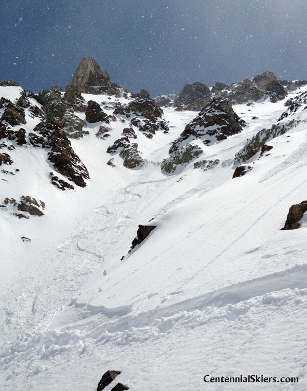
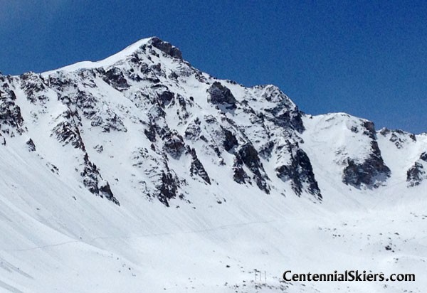
We made quick time up the low angle valley, marveling at all the amazing ski terrain surrounding us. This was my 10th Centennial Peak of the last two weeks but the first one we were attempting that held winter snow on a north aspect (Pacific and Fletcher were both northerly but we approached on south and east aspects) With the lingering deep and persistent slab problem in the Colorado snowpack on north and northwest aspects we tried to be as conservative with our decision making as we could and choose a route to skin up that was supported and lacked a big load. The snowpack in one of the north couloirs was well anchored by many large boulders (yes, shallow is weak, but can also provide good anchorage) So up we skinned and were actually able to skin all the way to the summit ridge. The views up here were excellent, as you come to expect on most of Colorado’s high mountains.
We wrapped around the south side and continued to skin the last 400′ up to the summit, occasionally taking our skis of to navigate some steeper terrain. The south side of the mountain also looks in great shape and would provide some excellent skiing if approached from just south of Alma.
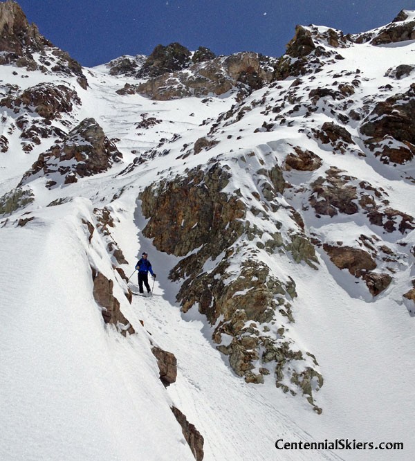
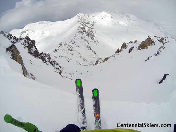
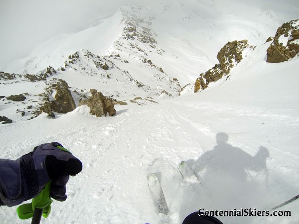
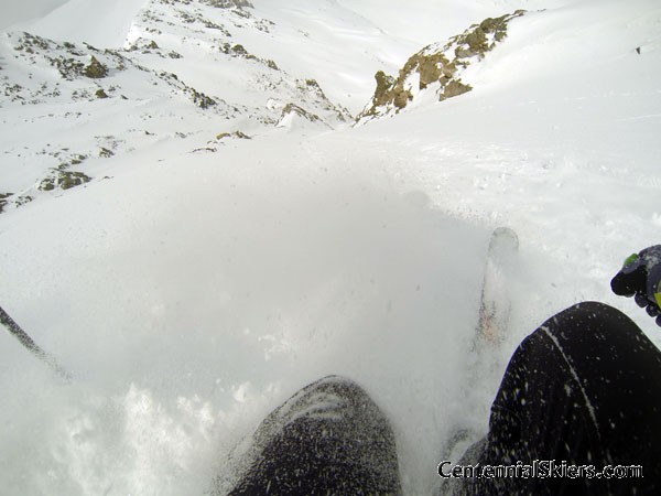
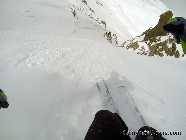
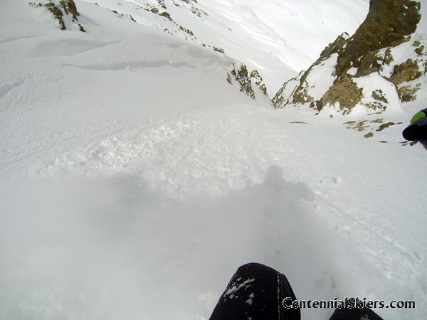
The weather was beginning to build as we pulled skins and locked our boots in ski mode. Light flurries floated across the southern end of the Ten Mile Range, but kept the sun from baking the slopes. Jon chose to ski back down the summit ridge and hit a wide and steep couloir next to the one we skinned up. Matt and I skied directly below the summit into a NW facing slope and couloir that provided some spicy steeps and an occasional “dry-dock” experience on rocks. We regrouped at the bottom of the couloir, all smiles and high-fives, before pushing off for the long, contouring descent back to the cars.
Another day, another amazing ski experience in Colorado. I am so fired up on these high 13ers as they’ve been offering great skiing, wonderful views and the customary epic experiences with friends. On the first ten peaks of this project I haven’t seen another ski or hiker out there. I’m pretty sure that might change tomorrow as I’m about to rendezvous with Ted and Christy and some Front Range friends for a ski of Mt. Meeker.
Thanks for reading,
Chris
And here’s a little GoPro sequence of the turns off the top-

Date: Jan. 10, 2009
Team: Christy, Ted
Route: Northeast Face
[Christy and Ted skied Buckskin back in 2009. Here’s an earlier report they made on the day]
Christy and I skied Mount Buckskin, in the Mosquito Range south of Breckenridge, outside of the town of Alma. Nearing her goal to climb the 100 tallest mountains in the state, or Centennial Peaks as they’re referred to, Christy still needed Mt. Buckskin (76th tallest), so we decided to give it a go.
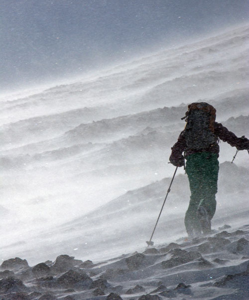
We’ve all seen the books, magazines and movies take images of airy ridge climbs and deep powder descents, and bundle it all up neatly, in an inspiring ski mountaineering package of sorts. Our day couldn’t be sold in that manner. In what I consider to be the less sexy side of the sport, we found ourselves in brutal conditions on an uninspiring mountain. High winds, cold temps and the resulting bitter wind chill factor quickly brought numbing pain to any exposed skin. The snow cover was sparse and hard on the skis and skins. Our gear and patience were put to the test the whole way up.
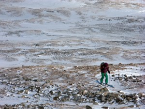
As for the descent, well, thanks to the unrelenting wind, the only route down followed a narrow lane of variable snow, interspersed with rocks and dirt. We found breakable crust, rock hard sastrugi and even some ice. When we came upon a pocket of soft snow, sharp rocks lurked beneath the surface, eager to catch our edges and knock us down. Fun.
As the photos will confirm, we won’t be filing this day on our Favorites list. And to answer the question, “Is it safe?”, well, from avalanches, yes. Safe from fracturing a patella, well that’s another story.
In the end, what matters is that we got it done safely. After all, you have to have the bad days to recognize the good ones. Put it in the books as #91 of the 100 Centennial Peaks that Christy has climbed. Only nine peaks left, hopefully all of which will be more enjoyable that this one.
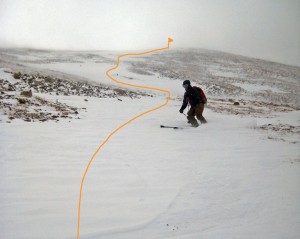
And upon Christy’s declaration that this was the “worst trip ever!” I had to remind her of some outright nightmares we’ve had through the years, to keep it all in perspective. It never takes long before you look back on things and realize it wasn’t that bad. Here’s a map from the day.