Mount Hope – 13,933 ft.
Date: May 3, 2013
Team: Dav, Pete Gaston, Max Taam, Ian Fohrman
route: Northeast “Hopeful” Couloir
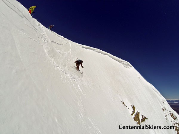
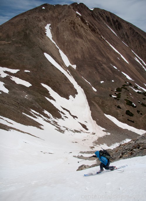
Ian Fohrman drops into the Hopeful Couloir while Max Taam and Pete Gaston look on.
After our day on Clinton and a soak at the Mount Princeton Hot Springs, four of us made our way up the Clear Creek Road towards Mount Hope. The road was dry to the Sheep Creek trailhead, and we followed the popular trail (also used in the Leadville 100 run course) up towards the East Ridge of Mount Hope.
From the summit, we dropped into the “Hopeful” Couloir to the northeast, skiing it down into the basin to the north of Hope Pass. A short jaunt up and over the pass brought us back to the Sheep Creek side and the route we ascended, and we were soon back at the car.
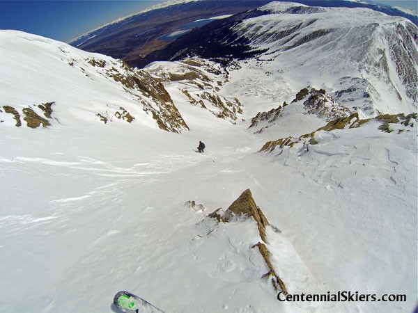
Looking down the gut of the couloir. Twin Lakes and the Mosquito Range lie in the distance.
(The map doesn’t have the summit correctly marked.)
__________________________________________________________________________________________________
Date: May 27, 2006
Team: Christy, Ted
Route: Southeast Bowl

The map and route up from Clear Creek Road. Our descent largely followed the same route back down the drainage until the snow dried up and we had to walk.
[Christy and Ted skied Hope back in 2006. Here’s a couple of thoughts from the day.]
We waited for Independence Pass to open and then went over to Mount Hope. By this late in spring, Clear Creek Road was snow-free as well, so the whole morning approach was actually pretty easy. After an easy two-hour drive from Aspen we were hiking up the south stretch of the Hope Pass Trail. The route is short and the trail climbs steeply right from the valley floor. Earlier in the season we could have probably skinned and skied right from the car, but this Memorial Day Weekend would only allow us to ski halfway down the valley from the summit, after hiking up the summer trail to treeline.
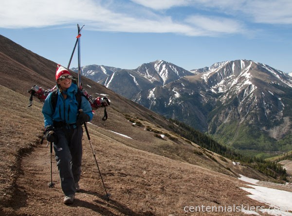
We chose to hike the mostly-dry trail to Hope Pass in hiking boots and then switched to ski boots at the snow. Oxford and Belford can be seen in the distance.
We didn’t really know it at the time, but there’s a more interesting, yet harder to access, couloir that descends the northeast side of the summit. It’s in pretty clear view when you drive past Twin Lakes and can be seen on the map above, descending to the little tarn in the basin between Quail and Hope. I think the route may warrant a return trip someday, maybe with Dav when he comes to ski this peak we can give it a closer look.
Quail Mountain stands behind as Christy skis the southeast side of Hope.